
Trace a Yukon Street by Address
A street search in Yukon works best as a chain of address-keyed records, not as a list of people. The Canadian County Assessor connects a Yukon situs address to a parcel and assessment-side owner or taxpayer label. Yukon City and County maps then help confirm the parcel, lot, block, subdivision, city field, and ZIP field. For a Yukon parcel, those details are the bridge to the Canadian County Clerk, whose land index is organized around parties, legal descriptions, subdivisions, section-township-range data, and document information rather than a simple street-address box.
The order below keeps the source labels intact. A Yukon owner label, recorded party, permit applicant, and old directory subscriber are separate kinds of evidence. When an address lies near the Yukon and Oklahoma City edge, check the Yukon City map before assigning a municipal connection. This Yukon address method favors a short, documented record trail over a broad claim about a whole Yukon street.
- Search the Canadian County Assessor property search by a Yukon address. Save the account, Parcel ID, situs address, owner or taxpayer label, and legal description exactly as shown.
- Use the Yukon Interactive Map and the County GIS hub to check the Yukon parcel, block, lot, subdivision, city boundary, road range, and postal overlay.
- Carry the Yukon legal description into the Canadian County Clerk land index. Use subdivision or STR mode when a street number does not find the relevant instrument.
- Read the newest Yukon deed first, record the parties, filing date, instrument type, document number, and legal description, then move backward through the earlier party or description.
- Use a Yukon permit date or a dated directory entry as supporting context, never as a substitute for a recorded transfer or a complete household list.
Note: A Yukon street record may show a property relationship while leaving household membership, protected addresses, and private customer information outside the record.
Yukon Street Directory Parcel Cards
The County’s Spatialest portal is the current parcel starting point for a Yukon address search. Its general search offers examples for account, address, owner, subdivision, and township. Filters available for Yukon property include land use, improved or vacant classification, sale date or sale price, year built, total area, neighborhood or subdivision, lot size, and legal-location fields. Results can be sorted by account, Parcel ID, situs, or owner name. The portal allows up to 300 Yukon property cards and an Excel export up to 500 under the inspected configuration.
A Yukon property card can hold a situs address, mailing address, owner or taxpayer name, account, Parcel ID, legal description, land and building characteristics, values, exemptions, sale data, and a map. A mailing field is correspondence information and may differ from the physical Yukon parcel. Likewise, a Yukon homestead exemption is an assessment fact, not proof of who is presently at the address. For a current amount due, Yukon parcel researchers should use the Treasurer rather than treating the assessor display as a payoff figure.
| Spatialest control | Field type | Useful Yukon street-directory use |
|---|---|---|
| General search | Text | Start with a Yukon address, account, owner, subdivision, or township. |
| Neighborhood / Subdivision | Text or filter | Connect a Yukon street address to subdivision vocabulary. |
| Section / Township / Range / Lot / Block | Numeric and text fields | Move Yukon parcel facts to the legal-description route. |
| Sale Date / Sale Price | Date and numeric range | Review a Yukon range without assuming one sale proves a complete chain. |
| Results sort | Control | Sort Yukon results by account, Parcel ID, situs, or owner name. |
The Canadian County Treasurer tax-roll search is a useful Yukon companion because it has a Street Address mode as well as Owner Name, Lot Block, Township Range, Property or Parcel ID, Tax ID, status, and school-district choices. Its results list year, tax ID, owner name, property ID, type, base tax, and total due. The portal cautions that payment updates are not a final payoff, so confirm a current balance for a Yukon parcel with the Treasurer.
The Canadian County Treasurer tax-roll search is shown in this Yukon street directory image.
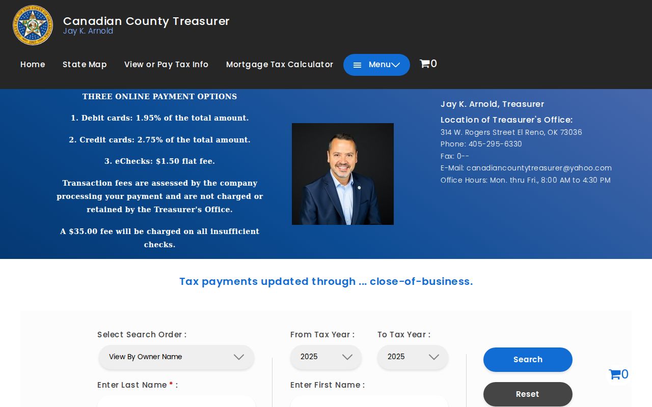
The distinct street-address mode is helpful after a Yukon assessor card supplies the precise situs wording, but it still reports a tax-record label rather than every person connected to the location.
Yukon Street Maps and Ranges
Yukon’s Interactive Map is the local check on physical geography. Its documented layers include the Yukon City boundary, addresses, Yukon parcels, subdivisions, zoning, wards, floodplain, and ZIP 73099 and 73036. The Yukon address-point layer carries Parcel ID, block, lot, street-number components, full address, city, subdivision, zoning or ordinance, unit or type, source or editor, and edit date. It does not provide owner information. This separation is useful: first establish the map location, then consult the assessment and land-record systems for the records that attach to it.
The Yukon road layer supplies full and label road names, left and right address ranges, parity, city, county, ZIP and ZIP+4 fields, plus legacy directional and street components. Those fields help catch a missing direction or a Yukon range mismatch in an old address. No reviewed official source identified a Yukon street-renumbering ordinance, formal E-911 assignment policy, or ZIP realignment. A mismatch should therefore be checked against the live map or local history source, not blamed on an assumed renumbering.
Address comparison. Yukon parcel research keeps the situs address, mailing address, legal description, and postal ZIP separate because all four can be accurate for different purposes.
Note: A Yukon mailing address south of NW 10th Street can be outside city limits, so use the City boundary layer before linking an address to a municipal service.
Yukon Deeds Behind Street Records
The Canadian County Clerk’s index supplies the recorded-instrument part of a Yukon address trail. Its name search for a Yukon record supports Direct, Reverse, or Either index choices plus party, spouse, commercial, date, document-type, and instrument-type fields. The subdivision search for a Yukon parcel supports lot, block, subdivision, dates, document type, and instrument type. STR mode uses section, township number and direction, range number and direction, quarter-quarter description, dates, document type, and instrument type. These modes matter because a physical address is not the Clerk’s main key.
For a name search involving a Yukon parcel, the Clerk instructs users to place an asterisk after both last and first names. A first initial followed by an asterisk broadens the first-name search. The document-information route for a Yukon instrument supports document number, result type, document type, four-digit document year, book and page ranges, file-date range, instrument type, and amount range. The Clerk advises small date intervals for a broad document-type search. Its example says mortgages filed from January through March 2002 totaled 4,437, and suggests a period of about a month or less to avoid a browser freeze.
| Index term | Meaning in the Yukon address chain |
|---|---|
| Parcel | A mapped Yukon property unit tied to an account or Parcel ID. It is a geographic reference, not a household list. |
| Situs address | The physical Yukon property address used by assessment and GIS systems. It can differ from the mailing address. |
| Plat | A recorded Yukon map that can establish subdivision, lot, block, or other legal-location context. |
| Criss-cross directory | A dated Yukon address-to-subscriber or occupant reference, not continuous proof of ownership or current residence. |
The Clerk’s document-information search is shown in this Yukon street directory image.
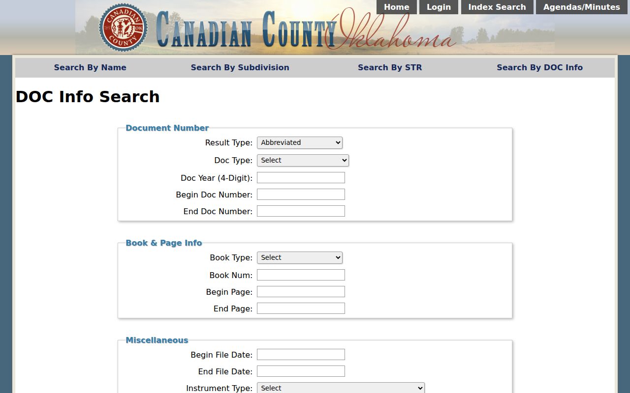
The form’s narrow date and document controls are most useful after a Yukon parcel, subdivision, or legal description has made the search specific. A named party on an instrument shows that party’s recorded role, not a direct street-address roster.
Yukon Street Permit Dates
Yukon Development Services adds a time layer to Yukon address research. The active permit portal and the separate Yukon past-permit portal can show permit issued date, expiration date, applicant name, electrical, mechanical, plumbing, or sign type, business name, status, inspection request, and a view option. The historical tool covers permits closed before March 28, 2021. The inspected source did not expose the live list of search-by choices, so it is better to use the portal’s current controls than to assume a particular address filter is available.
Permit evidence can date work at a Yukon property, distinguish an open or closed status, and help explain a physical change. It does not transfer title and does not create a complete directory of people at an address. When a Yukon inspection record is needed, the portal requires an access code, and the Development Services counter is the suitable route for a narrowly identified public record request. Development Services is at 334 Elm Ave. in Yukon and lists weekday hours of 8:30 a.m. to 5 p.m.
Yukon’s active permit search is shown in this Yukon street directory image.
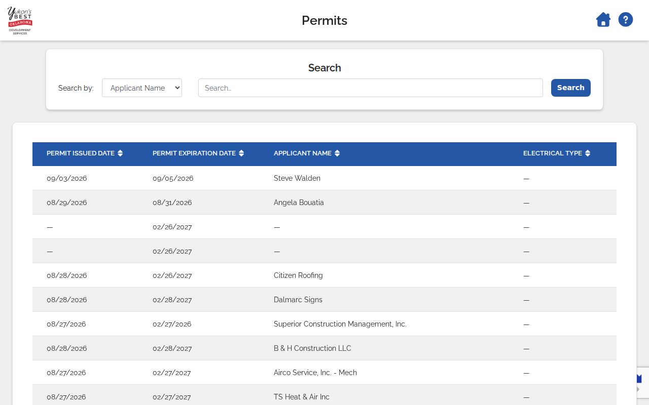
The active and historic permit split gives a Yukon address search a defensible time boundary. Check the correct portal first, then use the displayed record type and status only for what the record supports.
Yukon Street Record Layers
Several Yukon street record systems may be used together, but their outputs should not be blended into one claim. The Yukon assessor card identifies a current assessment-side connection. Yukon GIS establishes parcel and map context. The Clerk identifies recorded instruments and legal descriptions. The Treasurer adds tax-year detail, while Yukon Development Services contributes work history. The Oklahoma voter tools operate on a different access model and do not authorize a casual public visitor to browse people along a Yukon street.
| Address-record layer | Custodian | What it supports | Access and limit |
|---|---|---|---|
| Property card | Canadian County Assessor | Yukon situs, owner or taxpayer label, mailing details, values, and legal description | Spatialest portal; not every household member |
| Parcel geography | County GIS and Yukon map | Yukon parcel, subdivision, block, lot, city and ZIP context | Map layers; not title proof |
| Recorded instrument | Canadian County Clerk | Parties on a Yukon instrument, filing date, legal description, lot or block, STR, and document number | Index and counter; no direct street-address history |
| Tax roll | Canadian County Treasurer | Tax year for a Yukon parcel, owner label, property ID, base tax, total due, and status | Public search; confirm a current amount with the Treasurer |
| Permit history | Yukon Development Services | Yukon permit dates, applicant or business, work type, and status | Active and past portals; not title evidence |
| Voter-file data | State Election Board EDW | Residence and precinct data in an eligible Yukon record request | Restricted access and protected-record suppression |
The Yukon City code-report form is not a public code-case database. It accepts a Yukon location, violation type, narrative, optional reporter information, and uploads as an intake channel. For a defined Yukon address record that is not on a portal, use the City’s standard online records request or the Development Services counter instead of treating the form as a search result.
Yukon Address Fields Compared
Yukon’s proximity to Oklahoma City makes address labels especially easy to overread. The County GIS data dictionary separates Situs City and Situs ZIP, while owner and mailing fields separately preserve correspondence details. The City warns that businesses south of NW 10th Street can carry a Yukon mailing address while sitting outside Yukon city limits. Postal place name, utility service, school district, tax area, and municipal boundary are not interchangeable. Start with the mapped parcel, then compare the city boundary and legal description before choosing the custodian.
This is the practical comparison that keeps a Yukon address search accurate. The situs address identifies the physical parcel. A mailing address tells a custodian where correspondence goes. A legal description, such as subdivision, lot, block, or section-township-range, is the location language that persists through a Clerk deed chain. A ZIP is a delivery designation. The County parcel data also warn that a Parcel ID is geographic and not countywide unique, while the account is the appraisal-system identifier.
Yukon Land Index Eras
Canadian County’s verified land-index phases change the best approach to an older Yukon address. Land records from 1890 through 1986 are indexed by book and page. The 1987 and 1988 period is name only. From 1989 forward, the index uses name plus legal description. Most document images begin in 1890, although images require login and the County maintains complete public indexes. These are useful access distinctions, not proof that every image or field is available online for every instrument.
For the book-and-page period, take the address to a parcel and legal description, then ask Land Records how the older reference converts. For the name-only period, use parties with the legal description to distinguish similar names. Later records support both party and legal-description checks. The Land Records Department at 314 W. Rogers in El Reno records documents and conducts land-record and plat searches. It is the correct fallback for an image, plat, index-era question, or document-number mismatch.
Note: The Clerk’s online instructions do not publish a verified online starting year, so an unavailable result should be checked with Land Records rather than treated as absent.
Yukon Street Directory History
The confirmed historical address tool is a 1968 El Reno/Yukon/Edmond Criss Cross Numerical Directory in the Oklahoma Historical Society Reading Room. It is a useful dated lead for a Yukon address search because a criss-cross volume starts from an address and can point toward a subscriber or occupant for that year. The catalog result is not an online entry image and should not be portrayed as an unbroken Yukon address series. The OHS catalog and Reading Room are the right access channels for this specific volume.
Telephone-book runs add selected dates, but the confirmed Yukon holdings are discontinuous: 1955–67, 1969–72, 1986, 1991, 1994–96, 1998–2000, 2008, and 2009. Use a dated entry to form a lead, then compare it with the land record, map, newspaper, or permit date that matches the question. Historic Route 66 along Main Street, the railroad, and the city’s early Czech and Bohemian settlement help explain why older address material and notices often cluster around the historic core, but no street label should be modernized without checking the source wording.
Yukon Street Directory Limits
A mapped parcel, a recorded owner, and a tax-roll label do not make a complete household list. No official Yukon source located supports casual public voter browsing along a street. Protected voter and Address Confidentiality Program records can suppress home addresses. Driver information is controlled separately, private utility-customer and delivery data are not ordinary street records, and the County found no official neighborhood-member or block roster. A historic subscriber entry also cannot prove a current connection to the same address.
Lawful use. Yukon address records are for personal, lawful research. Oklahoma’s anti-stalking statute, 21 O.S. §1173, prohibits using information to stalk, harass, threaten, or harm another person.
When a record seems wrong, contact the office that holds it. The Assessor handles assessment data, the Clerk handles index or document questions, the Election Board handles registration data, and the City handles its own municipal records. An Oklahoma Open Records Act request should reasonably identify the record, time frame, and search terms. That targeted approach protects both accuracy and privacy.