
Yukon ZIP Coverage
Three verified Yukon postal or map references matter when sorting Yukon address geography: 73099, 73085, and a 73036 overlay in the Yukon Interactive Map. They are not three interchangeable Yukon geographic descriptions of the same area. The evidence for 73099 is a set of Yukon physical public locations and the USPS Yukon Post Office. The evidence for 73085 is the City’s P.O. Box 850500. The City map includes 73036 as an overlay, which is useful geographic context but does not prove that every mapped address is inside Yukon.
| ZIP | Verified Yukon connection | Post office or source | Careful use |
|---|---|---|---|
| 73099 | Used by Yukon City Hall, Court, Library, and the USPS Yukon Post Office | USPS Yukon Post Office, 900 Garth Brooks Blvd. | Confirm a particular delivery address with USPS. |
| 73085 | Used for Yukon City departments’ P.O. Box 850500 | City mailing address evidence | Do not claim an exclusive delivery boundary from the reviewed sources. |
| 73036 | Appears as an overlay in Yukon’s Interactive Map | Yukon Interactive Map | Mapped postal geography, not proof of Yukon municipal limits. |
For a Yukon 73099 address, the public facility and post-office evidence confirms a Yukon physical-location ZIP, not every route or boundary. For 73085, the source supports a Yukon City mailing or box-address explanation, but no official source reviewed proved it is exclusively a post-office-box ZIP. The Yukon 73036 layer is a mapping tool. It should prompt a City-boundary and parcel check, not a conclusion about delivery service or jurisdiction.
The USPS Yukon Post Office location page is shown in this Yukon postal-reference image.
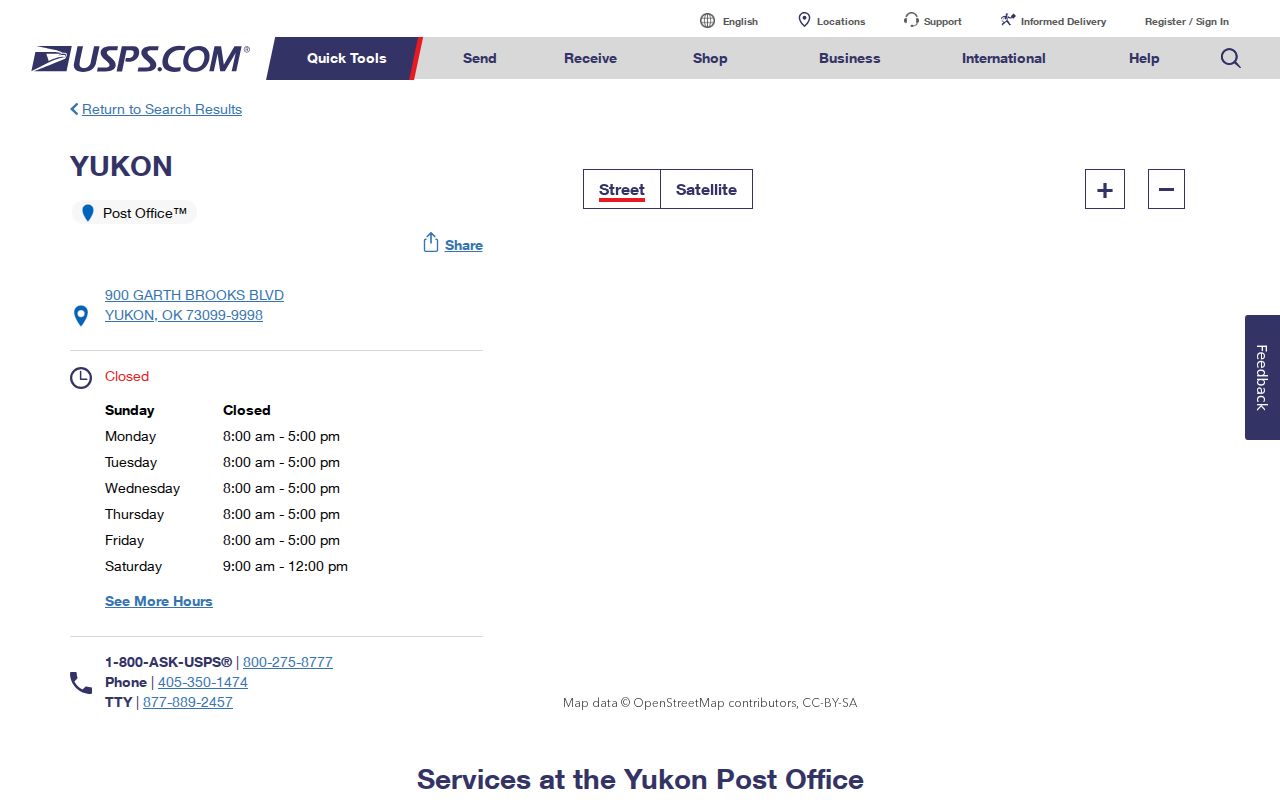
The post-office page establishes a known Yukon physical location and a contact point, while the USPS address lookup is the more precise tool for confirming a particular mailing address.
Verify a Yukon ZIP Code With USPS
A Yukon city name is not the final authority for a delivery ZIP. Use the USPS address lookup to standardize a specific Yukon address before using a record system. That confirmation answers a postal question. It does not establish Yukon city limits, a tax area, school-district status, or a legal parcel boundary. Keep the USPS result next to, rather than in place of, the County and City records for the same address.
Yukon’s own guidance sends people uncertain about their address to the Interactive Map, particularly because the city adjoins Oklahoma City. The City says businesses south of NW 10th Street can carry a Yukon mailing address while being outside city limits and not contributing Yukon sales tax. Utility service, postal place name, school district, tax area, and Yukon municipal boundary are separate fields. A precise delivery result is still valuable, but it must be read for what it is.
The USPS postal lookup is shown in this Yukon postal-reference image.
Use the postal result as the starting label for an exact Yukon address. Then switch to the Yukon map, County GIS, Assessor, or Clerk according to the question being asked.
Yukon ZIP Overlay Limits
The Yukon Interactive Map gives postal geography a local context. Its documented layers include the City boundary, addresses, Yukon parcels, subdivisions, zoning, wards, floodplain, and ZIP 73099 and 73036. A road can also carry city, county, ZIP, ZIP+4, and left or right address-range fields. These layers are useful for a street-number typo, a directional component, or a first look at whether the parcel lies near a city edge. They do not establish title, full household membership, or a postal delivery boundary by themselves.
The boundary question is especially important because Yukon is on the eastern side of Canadian County beside Oklahoma City. A Yukon mailing label can coexist with an Oklahoma City service or tax context. The correct sequence is to check the City boundary map, then look at County GIS or Assessor situs-city information and the legal parcel. The County Clerk’s recorded legal description remains the reliable bridge into land-record research. The map tells you where to investigate, not which record wins every disagreement.
Boundary check. A Yukon ZIP is postal geography. Confirm municipal context with the City map and parcel context with Canadian County data before making a records request.
Yukon Parcel Fields Split Geography
Canadian County’s parcel data dictionary separates several fields that look similar at first glance for Yukon parcels. Situs City is municipal location. Situs ZIP is postal geography. Owner and mailing fields separately identify correspondence information and its city, state, and ZIP. Legal description, whether subdivision and lot or section-township-range, is the title and parcel bridge used in recorded instruments. A Parcel ID is geographic and not countywide unique, while the account is the appraisal-system identifier. Preserve the field names as displayed instead of replacing all of them with the delivery address.
This comparison is the core of a reliable Yukon postal search. A Yukon mailing address may be outside Yukon or outside Oklahoma without moving the parcel. A valid postal ZIP does not change the situs city. A legal description can remain stable across a deed chain even if an address label changes. The County’s Parcel Data Export Appendix also says one legal description may split into multiple parcels when it crosses a jurisdiction or quarter-section, and that the data are not a survey.
- ZIP and ZIP+4
- A ZIP identifies postal geography. The extra four digits provide a more specific delivery segment; Yukon road data can carry ZIP+4 fields.
- PO-box ZIP
- A ZIP used with a post-office box or mailing address. Yukon’s 73085 evidence supports City box use but does not prove an exclusive boundary.
- Unique ZIP
- A ZIP associated with one receiving point. The reviewed Yukon sources did not identify a unique ZIP, so none should be assumed.
- Carrier route
- A postal delivery grouping. It is not a city-limit line, parcel boundary, or resident list.
Note: Treat a mailing label and a situs field as separate facts until the County record and City map show they describe the same parcel context.
Search Yukon ZIP Code Records
There is no verified public Yukon portal that turns a ZIP into a comprehensive directory of people. The County Assessor’s Spatialest search locates parcels by account, address, owner, subdivision, or township, but no native ZIP filter was found. The Treasurer supports street address, owner, lot block, township range, property or parcel ID, tax ID, amount, status, and school-district modes, but its published form does not advertise a ZIP selector. The ZIP is therefore a validation or segmentation field in local records, not a universal key.
- Confirm the exact Yukon delivery ZIP with the USPS lookup and write down the address format it returns.
- Open the Yukon Interactive Map to check City boundary, address, road-range, and ZIP-overlay context for the physical location.
- Search the Canadian County Assessor by the specific Yukon address, then preserve the account, Parcel ID, situs city, situs ZIP, and legal description.
- Use the legal description in the Canadian County Clerk land index when a recorded document or plat is needed.
- For eligible voter-file work, ask the Election Data Warehouse about a restricted custom residence-ZIP extract rather than treating a ZIP as a public browse tool.
Once a ZIP narrows an address question to a particular road, the Yukon streets directory has the address-to-parcel and deed workflow. It is more accurate to follow that route than to infer a street-wide result from a postal label.
Yukon ZIP Search Fields
The local tools have different relationships to ZIP data. USPS confirms delivery addressing. The City map displays postal overlays and address context. Spatialest searches a property record without a native ZIP option. The Treasurer has useful property modes but no published ZIP selector. The Election Data Warehouse can produce a custom residence-ZIP extract only for eligible requesters under its access and use limits. This is why a Yukon ZIP code directory must identify the tool that actually accepts the information in hand.
| Official tool | ZIP-related function | What the source confirms | Limit |
|---|---|---|---|
| USPS ZIP Code Lookup | Address standardization | Use it to verify a particular Yukon mailing address. | Does not establish city limits or parcel title. |
| Yukon Interactive Map | Postal overlay and address context | 73099 and 73036 overlays plus roads, addresses, and City boundary layers. | Not an owner or household directory. |
| Canadian County Assessor | Parcel lookup | Address, account, owner, subdivision, and township search examples. | No native ZIP filter located. |
| Canadian County Treasurer | Tax-roll lookup | Street address, owner, lot block, township range, parcel, and other modes. | Published form has no ZIP selector. |
| Election Data Warehouse | Custom residence-ZIP extract | ZIP can be part of an eligible requester’s structured file request. | Restricted access and protected-record controls apply. |
Yukon Maps for Old Addresses
Historic Yukon address work needs a date before it needs a modern ZIP. Yukon has Sanborn editions for 1894, 1895, 1898, 1901, 1904, 1909, 1913, 1920, 1929, and 1943. Oklahoma Historical Society fire-insurance rating booklets cover 1900–03 and 1905–10. These sources can place an older street or lot in built-form context. They do not name a present household, and a current postal overlay should not be substituted for a historical address label.
Later evidence has distinct time ranges. The confirmed 1968 El Reno/Yukon/Edmond Criss Cross Numerical Directory is available in the Oklahoma Historical Society Reading Room. Confirmed telephone-book holdings are discontinuous, beginning with selected 1950s material. Yukon Sun digitized material covers the 1890s through the 1960s and has 2,776 items, but its searchable OCR should be checked against page images. Pair a dated Yukon directory or notice with the County parcel and Clerk legal-description trail only when the dates and source labels fit.
Yukon ZIP Code Boundaries
A Yukon ZIP code does not create a resident list or establish jurisdiction. The City boundary, postal geography, school district, tax area, utility service, parcel situs, mailing label, and legal description can point to different systems. Canadian County’s Parcel Data Export Appendix B shows Yukon school-district territory can coincide with Yukon City, rural or no-city-tax, or Oklahoma City tax areas. School district and mailing name therefore cannot settle municipal classification.
The same restraint applies to people-related records. An eligible voter-file extract has protected-record controls and is not a casual public ZIP browser. Yukon mapped parcels can identify physical context, not all people at an address. The Yukon and County systems should be used for personal, lawful research only. Oklahoma’s Address Confidentiality Program and restricted voter protections can limit release of home-address data, and those safeguards should never be bypassed or inferred from older records.